During the past year I have been out walking or running each morning before starting work. One of my routes takes me past places that have an archaeological or an historical story to tell. Passing by these sites gets me set up for the day as I think about these places and how they may once have been in the past and helps me to prepare myself up for a day when hopefully I shall be making my own contribution towards an understanding of the past.
My route leads out from Penarth along the coast path where I soon pass the spot that was the inspiration for Alfred Sisley’s 1897 painting: The cliff at Penarth, Evening, Low Tide which is in the Museum’s collection.
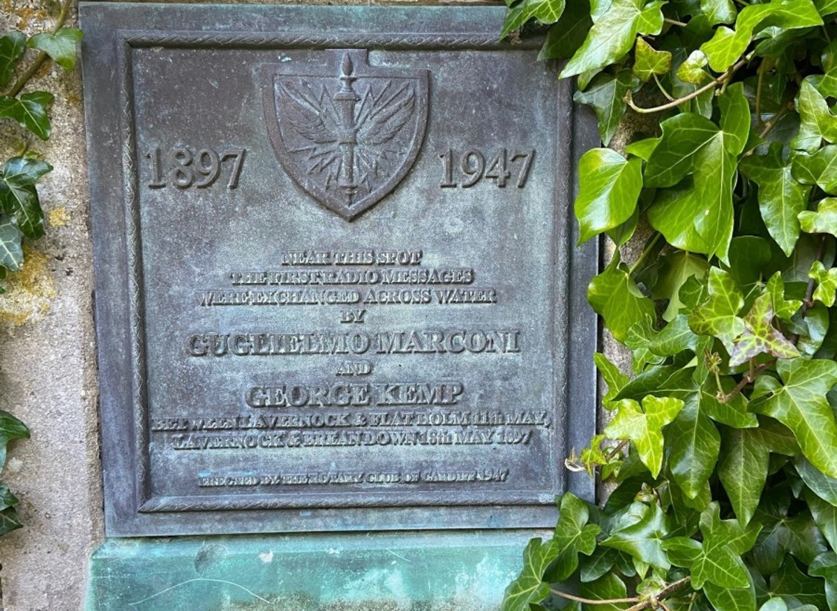
In the distance Lavernock Point can be seen and my route takes me along the cliff tops to the point. The same year as Sisley painted his painting, Lavernock Point was serving a different purpose. It was here that the Italian inventor Guglielmo Marconi set out to make a transmission across to Flatholm, an island in the Bristol Channel, using his newly invented wireless radio equipment. He used a zinc cap fixed to a pole on the clifftop before he decided to move it to the beach where he succeeded in connecting the signal and making his transmission in Morse code.
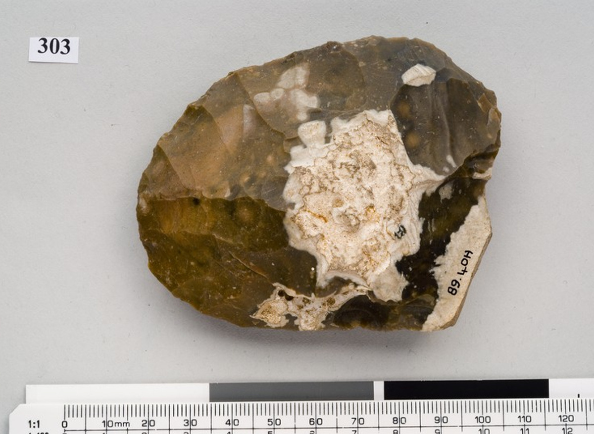
Turning far further back in time when technology was rather less complex it was close to this spot in these same cliffs where a handaxe was dropped by its Palaeolithic user. This handaxe may be 200,000 years or more old. It is still sharp and would have been an excellent tool to use to butcher the carcasses of the large mammals such as rhinoceros, horse and deer that would once have roamed the landscape.
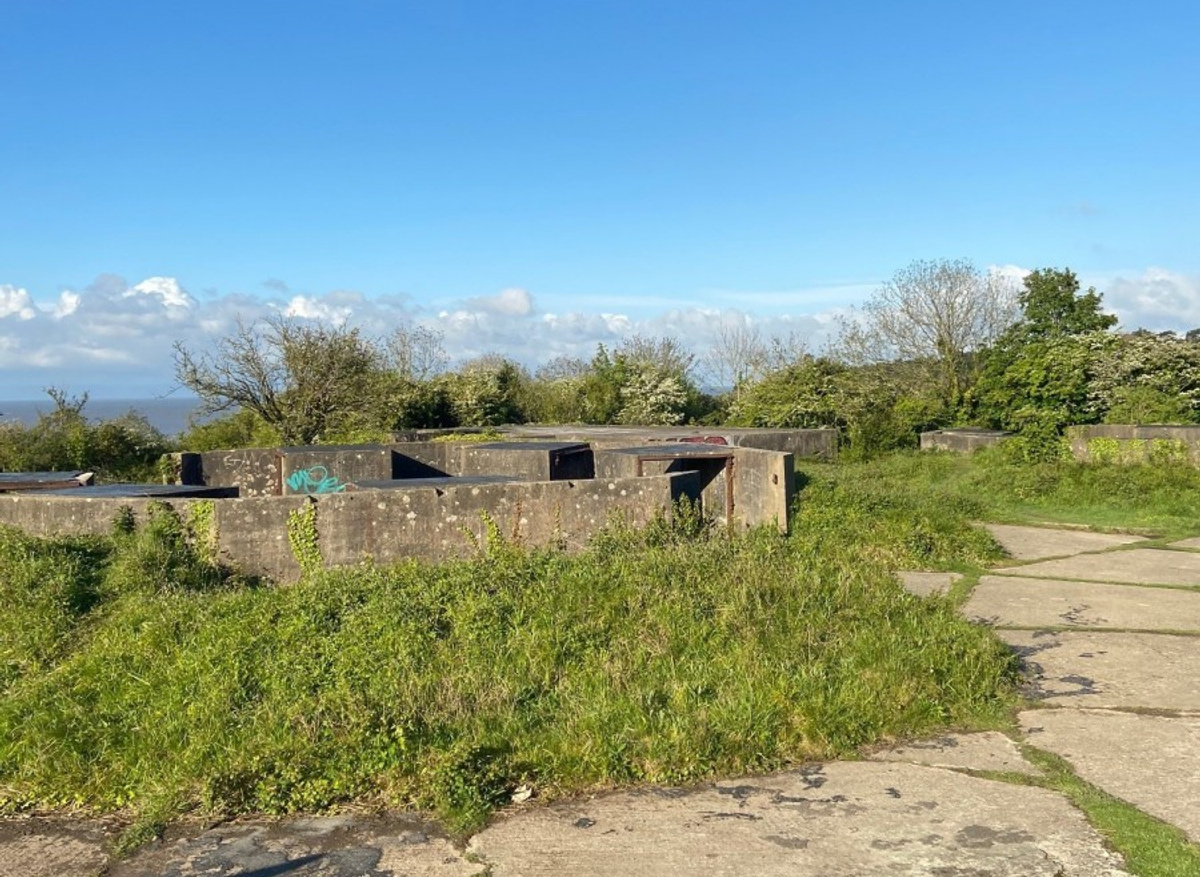
After cutting inland slightly to pass the holiday park named after Marconi, the coast path returns to sight of sea. Just along from here lies another interesting spot, Lavernock Battery. This was originally built in the 1860s, part of a series of defences designed to protect access into the Bristol Channel. It is one of several military installations known as Palmerston Forts. During the Second World War it served as a gun emplacement to protect this part of the coast and the buildings to be seen today were those constructed at this time.
Returning to the coast path an outlying gun emplacement can be seen and beyond it lies Sully Island. This island has an Iron Age promontory fort on its eastern edge, it is now gradually eroding away into the sea, but the defensive bank and ditch can be clearly seen.
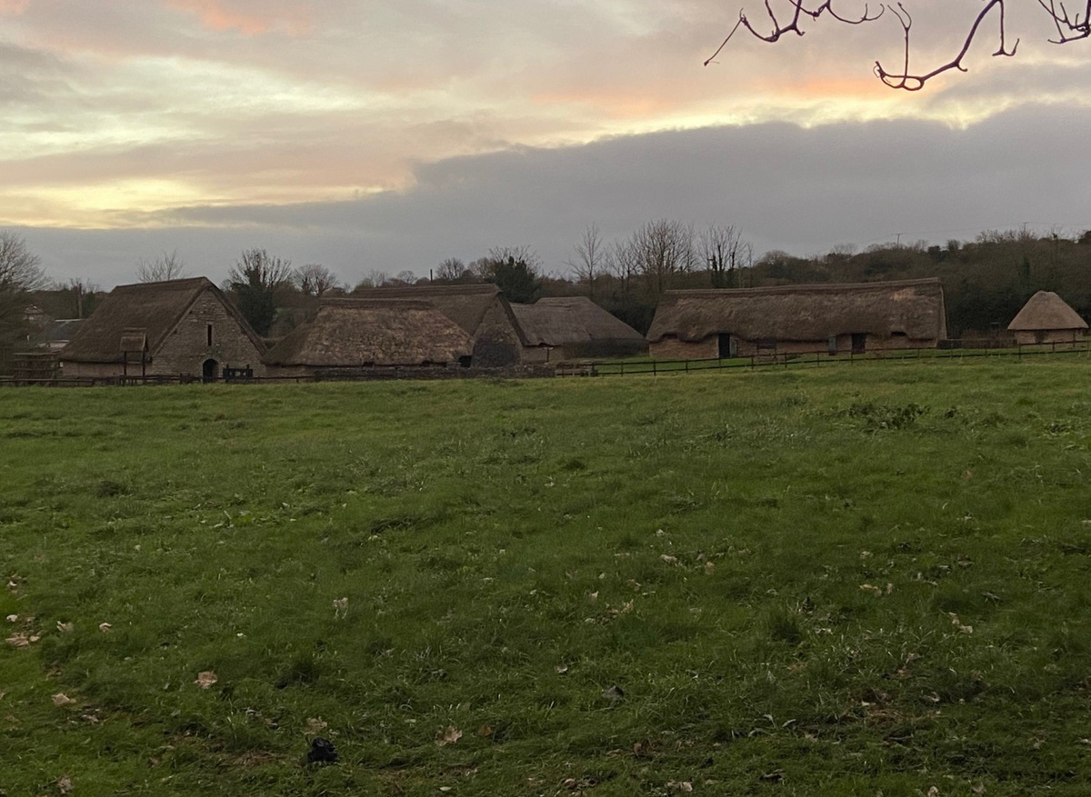
After passing around the Bay Caravan Site I meet St Mary’s Well Bay Road. Leaving the coast path here I turn right and head inland. Crossing the main road, I enter the Cosmeston Lakes Country Park which has a rich and long history. Taking the first concrete track on the right I come to the entrance to the reconstructed medieval village. Originally a medieval manor, first documented in the 12th century most of the buildings that have been excavated date mainly to the late 13th or the early 14th centuries. The village was short lived and was in decline by the end of the 14th century, although may have continued in use to some extent into the post-medieval period. Today buildings have been constructed on the site and visitors can obtain a glimpse of life set at AD 1350.
A quick walk through the Cosmeston housing estate takes me to the route of the old railway and back towards Penarth. This disused railway once linked Penarth with Barry via Cosmeston and Sully and today provides a flat route back into the seaside town.