Planning and Archaeology: A Successful and Mutually Beneficial Relationship
Planning and archaeology have a mutually beneficial relationship.
Both revolve around the connections between people and places. Planning policy exists to create the places we need to live today, it’s about getting the right land use in the right place to meet contemporary challenges and needs. Planning helps us create great places for people to live and work, thrive and be happy. Archaeology has a key role to play in this as it enriches our understanding of a place, and the people who have lived here before us. It gives time depth to our places and our associations and interactions with them. This in turn establishes meaning for local people, a sense of belonging and pride of place. Archaeology draws out what makes a place special, distinctive and significant.
It is 30 years since the introduction of Planning Policy Guidance 16 (PPG16) changed the way archaeology is treated in the planning system. It is now funded through the development of sites and requires the planning system to effectively and fairly deliver its substantial public benefits. Since 1990 this approach has generated a huge quantity and range of new knowledge about the past and the places we live while at the same time helping development to proceed.
This mechanism for ensuring archaeology is addressed within the planning system delivers public benefits in terms of our increased understanding of the extent and richness of the surviving evidence of our past, while simultaneously reducing the risks to developers through a clear process for the identification, assessment and recording of archaeological evidence in advance of development. New knowledge has created an ever more detailed picture of our past, which is itself a resource to help inform future development potential.
Development led archaeology in historic cities like York has filled in so many gaps in our knowledge about their past iterations that The Historic Towns Trust has developed a series of maps and atlases mapping out the medieval, Anglo Saxon, Roman and pre-industrial settlements that are still buried under our bustling towns and cities.
Archaeological discoveries in other locations can take us by surprise. No one expected an Iron Age chariot burial to be found under a housing development outside Pocklington in East Yorkshire. Thanks to an archaeological assessment of the site before planning this was excavated before the construction workers moved in.
A pre-determination assessment of land proposed for 203 new houses outside Thame in Oxfordshire uncovered evidence of activity from the Mesolithic, Neolithic, Bronze Age, Iron Age and Roman periods. A programme of archaeological investigation over 40% of the development area resulted in significant discoveries from each of these periods. The archaeology informed a re-design of subsequent phases of the housing development to achieve preservation of remaining archaeology in situ, whilst also enabling the development to go ahead. The current residents are a continuation of 5000 years of human occupation on this site. Oxford Cotswold Archaeology, the archaeological contractors on-site, went on to host a series of school visits, tours of the site and an exhibition in Thame Town Hall to disseminate their findings to local residents, enhancing an understanding of the time depth and importance of where they live.
There is a wealth of research and findings concerning the positive social impact for local communities in terms of both place-shaping and wellbeing, generated by participation with what makes their place distinctive. Community participation around place-shaping is both empowering and inclusive. Is this what Bellamy Homes (the developer of a housing development near Warboys in Cambridgeshire) realised when they funded the equipment for a local archaeology group to join the excavations run by Oxford Archaeology in advance of building 71 new homes on the site? Archaeological mitigation for the development of this site discovered Roman remains, with some late Iron Age and later Saxon activity on the site of the abandoned Roman settlement in the 5th and 6th centuries AD. Roman settlements of this wealth and density were previously unknown in the parish and add significantly to knowledge of Roman activity in the Cambridgeshire Fens. In addition, the continuity of activity from the late Iron Age, through the whole of the Roman period and into the early Saxon period is very unusual.
Since 1990 the planning system has been one of the main mechanisms for securing archaeological knowledge and interest. Often via excavation and public dissemination, this knowledge can be made widely available to the public and helps transform our understanding of the places in which we live. Only a very small fraction of our country’s story is documented in written records. We rely on archaeology to fill in the gaps and improve our knowledge and understanding of the past and the way people lived before us. The planning system is a crucial mechanism for unlocking the potential of undiscovered archaeology for the discovery and knowledge it is yet to yield. It is a proven system that works, prevents delays and delivers substantial public benefits.
We must not abandon the proven successful relationship that has been established between planning and archaeology. We need to Speak Up for Archaeology – we need your help and support to do this and make our voice heard.
One simple step you can take is to write a letter to your MP and you can find some helpful guidance on how to do this in our toolkit here.
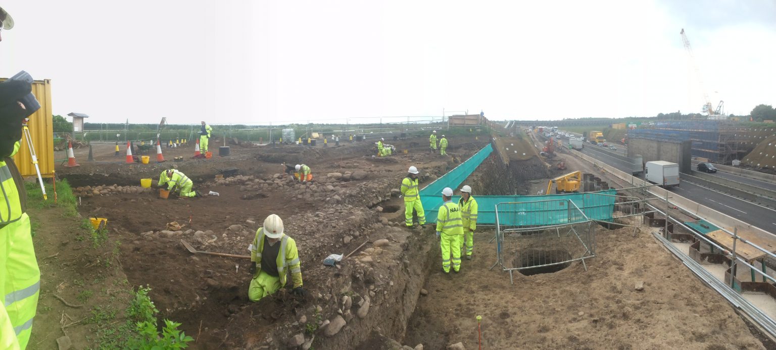
Catterick Roman Settlement, North Yorkshire in advance of the widening of the A1 © Neil Redfern.