AI Mapping of Historic Landscapes for Nature Recovery
at National Scale
Archaeology and nature are often treated as separate priorities, but they are really two sides of the same landscape story.
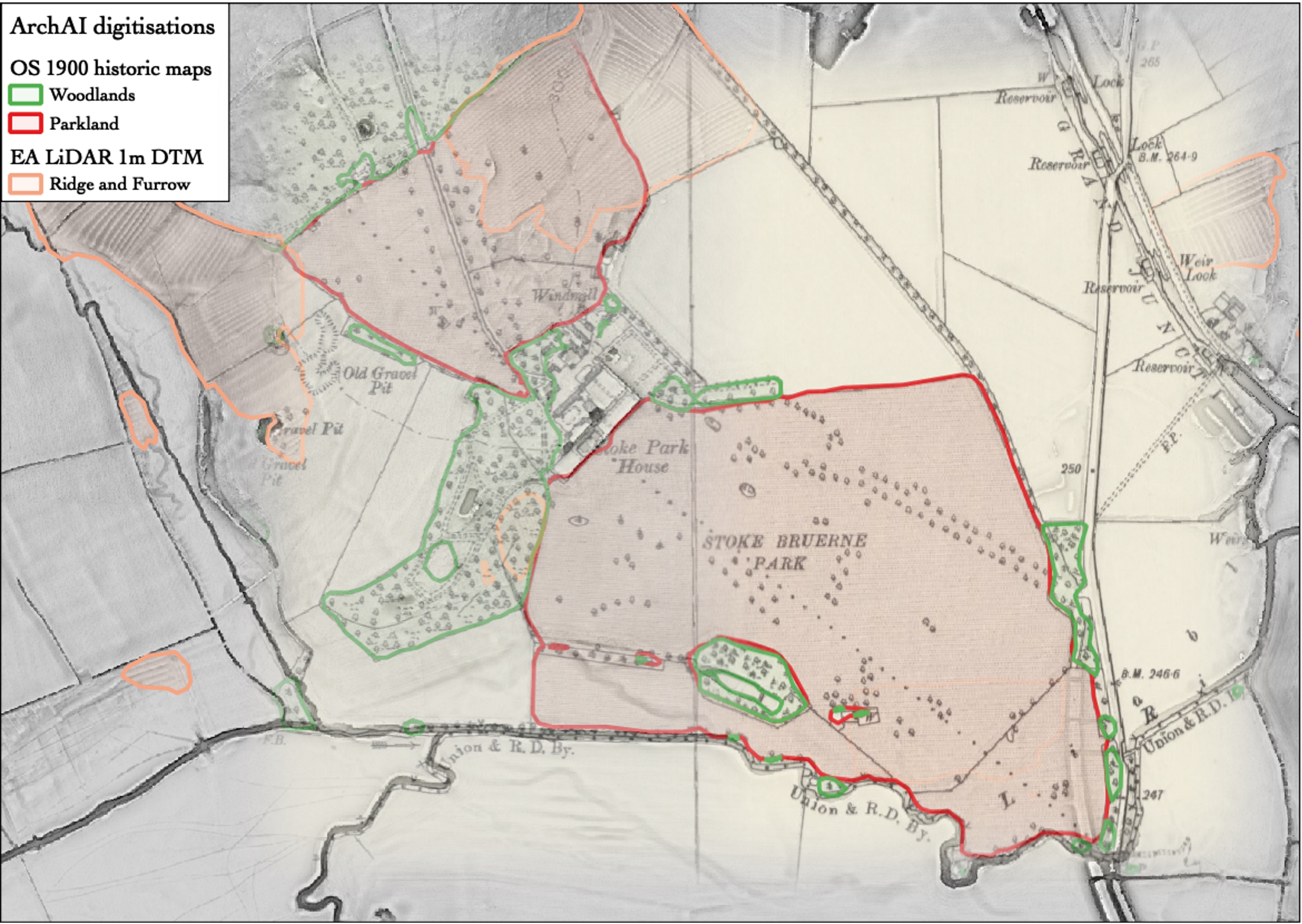
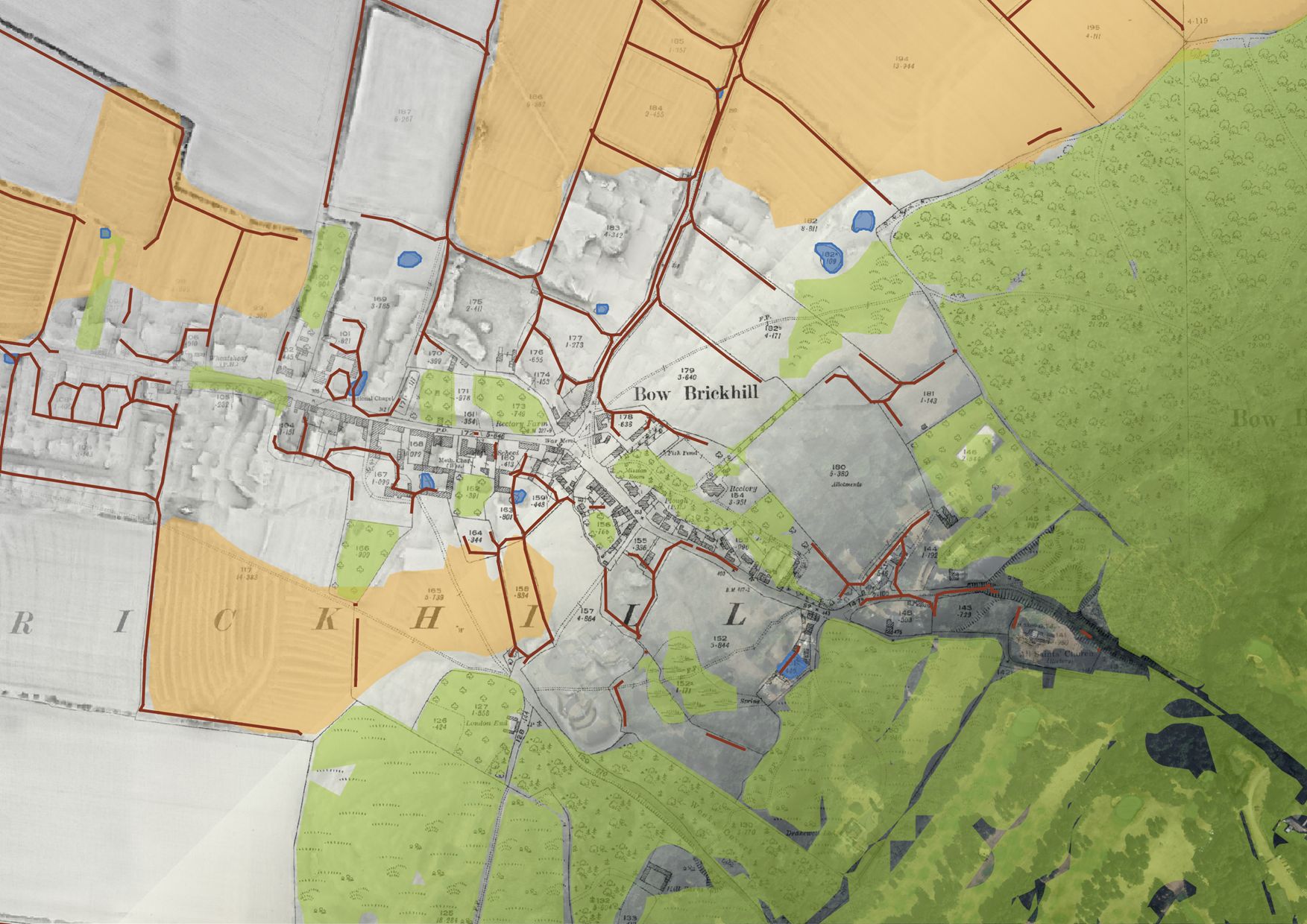
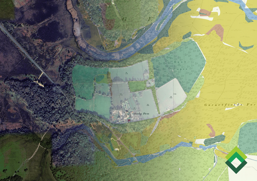
ArchAI uses AI to detect historic features at national scale, combining earthwork detection from LiDAR with habitat mapping from historic Ordnance Survey maps. This creates practical evidence for land managers and planners who need to make decisions quickly, and defensibly.
In this talk, I will show how these time layered datasets can support organisations such as the Forestry Commission to plant trees without accidentally damaging the historic environment. By identifying earthworks and other surviving landscape features, we can steer woodland creation away from monuments that are worth protecting, while still delivering nature recovery at pace. The same historic perspective also helps reveal where restoration is most likely to work. We can map where rivers once meandered before being straightened, helping target river restoration that reduces flood risk and improves habitat. We can also identify “ghost ponds”, historic ponds that have been filled in but still hold seedbanks, so that restoration can bring back wetland species that have been absent locally for a century.
Ultimately, this talk argues for a more joined-up approach to land management, one where historic landscape evidence directly informs nature recovery. By detecting past habitats and surviving earthworks at scale, we can reduce unintended damage, target restoration where it is most likely to succeed, and give organisations clearer, data-led options for planning, funding, and delivery.
Speaker

Dr Iris Kramer
This event is part of the CBA's Festival of Archaeology. Find out more about events taking place across the Festival fortnight from 18 July - 2 August 2026 by clicking the button below.