Jack Brown is a third year Bournemouth University Student, currently on a 40 week placement with the New Forest National Park Authority’s archaeology team.
I first heard of the New Forest National Park Authority (NPA) giving archaeological students the opportunity for a year-long placement at a seminar held at Bournemouth University in early 2018. This interested me so I decided to enquire and ended up meeting Lawrence Shaw (NPA Archaeological Officer) to discuss the opportunity. After this, I was interviewed at the offices in Lymington where I gave a short presentation to Lawrence and NPA Community Archaeologist, James Brown. This was challenging but a great chance to improve on my interview skills for a job in the archaeological industry in the future. Soon after, I received an email from Lawrence and James saying I was accepted as a placement student and that I would be starting in October.
My year at the New Forest National Park Authority can be split into two parts. The first part of the placement consisted of using online mapping (GIS) to ‘georectify’ aerial photographs of the New Forest, taken by the RAF during the Second World War. This means finding the real-life location of a coordinate-less image and is very useful for identifying archaeology that may be clearer 50 years ago than in the modern day. GIS was a subject I opted to study during my second year at university and is a tool that interests me and a skill that I wanted to expand on. It was a challenge to learn a new GIS system but it was made easier through good support, teaching materials and advice.
Alongside the GIS project, I was able to work with James on a number of different local heritage projects. One example of this is the Cultural Heritage Fair that James organised. The event took place at Lyndhurst Community Centre and was a great chance to see all the heritage groups come together to discuss their research.
I also worked with Lawrence and NPA volunteers in field surveys where we undertook walk-over surveys of an area that had been surveyed using Lidar (Light Detection and Ranging)(link is external), which is when a laser is beamed from a plane to create a detailed 3D map of the terrain underneath the Forest’s canopy. Lawrence and I divided the groups into two, which gave me the chance to develop my leadership, communication and identification skills, and I truly felt that I was improving on these each time we did a survey.
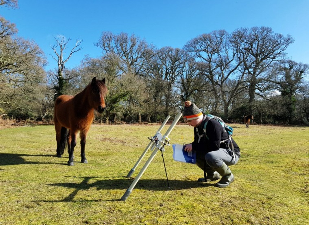
This was my research project that involved a geophysical survey of the Romano-British pottery kilns at Sloden Inclosure, Fritham. To begin, I wrote a desk-based assessment (DBA) of the Inclosure, which included the known and easily accessible history of the area. I would like to thank NPA Senior Archaeologist Frank Green for his consistent supervision of my drafts. After writing the DBA, a written scheme of investigation outlined the project plan. Due to there being a number of stakeholders, multiple permissions were needed from Historic England (as the sites are scheduled), Forestry England (the landowners) and Bournemouth University (for the use of their equipment). The last thing needed was to round up willing volunteers. This was the admin that was needed to be done before the survey took place and it was a great experience for me to see the logistics behind a project.
The survey took place from 12–20 March and required me to brief the volunteers at the start of the day, before assigning them to their jobs. I would then use a ‘gradiometer’ to survey. A gradiometer allows archaeologists to map magnetised archaeological features . This was an amazing chance for me to better my geophysical skills and further my understanding of geophysical surveying. This project was particularly important as it has allowed me to see if I am suited to undertaking geophysical survey work as a career option.
Another of my favourite bits of the year was the community dig in Burley. This was a project led by James and involved willing residents digging a 1m by 1m test pit in their garden. This four-day event began on 11 April and finished on 14 April. It also included workshops that were done by professionals, as well as a talk by the producer of Time Team, Tim Taylor. For this project, I had been assigned the role of ‘Education Officer’. This meant that I had to supervise children and their families who wanted to participate. This was an enjoyable part of the placement as it was great to see the community of Burley not only having an interest in archaeology, but also coming together to discuss archaeology, history and their finds from Burley.
Can you name four skills you have gained or developed during your placement?
During my time working at the NPA, I have been fortunate to learn and improve on skills that will be useful for my future career.
These are:
- Technical skills: I have really developed my skills in a number of different techniques associated with mapping and recording archaeology. These have ranged from GIS, GPS recording and geophysical survey techniques
- Report writing: I have had to produce several written reports, including desk-based assessments, written schemes of investigation and final survey reports. All of this has helped me to understand how to structure these documents and write in the correct style.
- First aid: I was fortunate enough to be sent on some professional training to enhance my skills and CPD at Brockenhurst College
- Organisational skills and people management: the placement has really helped me to improve my organisational skills to make sure I get the best results from my work as well as my ability to coordinate and manage different people.